UK Suspect
CTF · ctf.osint.industries
Challenge Overview
The goal of this challenge was to determine the location of two suspects based on a series of photographs and contextual clues. The flag format the exact GPS coordinates where the photo was taken and provided in latitude in degrees North followed by Longitude in degrees West.
Initial Analysis
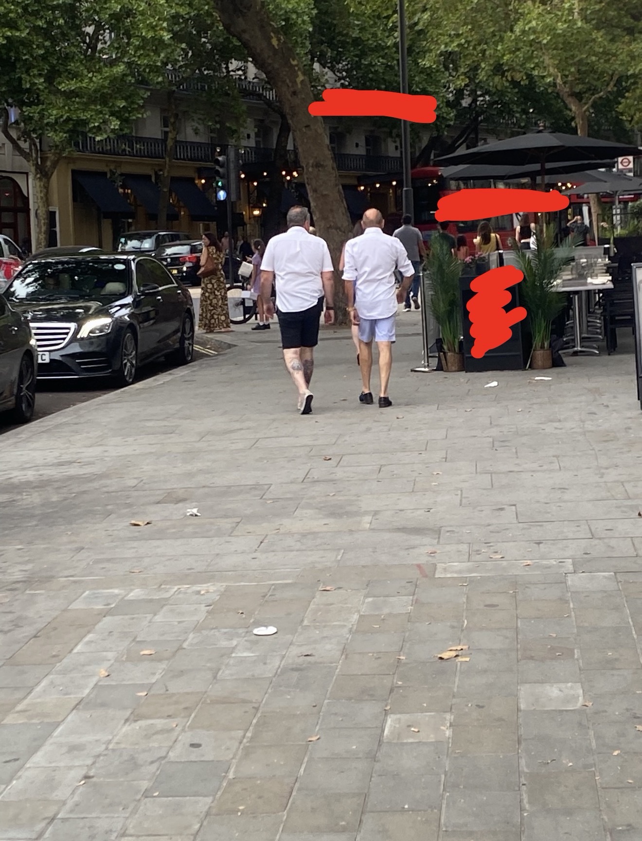
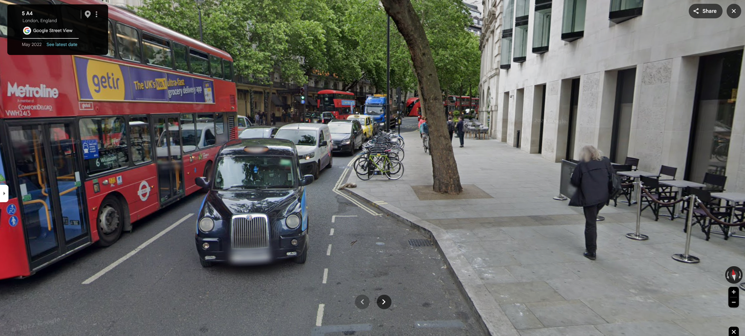
To start, I knew this photo was taken in England based on the fact that people was driving on the left side of the road. An important way to differentiate the UK and Ireland (both drive on the left of the road) is by the lisence plate. The UK have yellow backplates and white frontplates while Ireland mainly only have white plates.
One clue that clues me to London more specifically is the presence of a distinctive red double-decker bus in the background and the double outside of the road.
Finding the Location
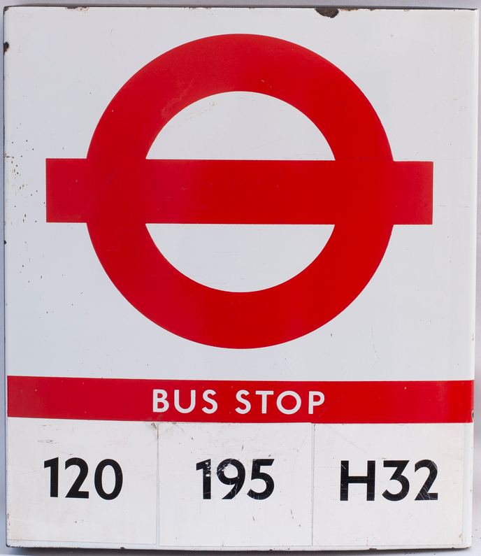
Since there are no visable words in this photo, I had to rely on other visual cues. The photo gave off residential vibes so I was hoping it would be closer to the heart of the city. One thing that stuck out was the red sign in the background. After a quick Google search I was able to find the sign and it turns out to be a bus stop sign.
Another thing to note was the lush trees surrounding both sides of the road. Trees are usually a great way at finding locations especially these size since they will stick out on google street view.
One usefull application that can be essential for this type of analysis is Overpass Turbo. Overpass turbo allows for advanced querying of OpenStreetMap data, which can be useful for identifying specific features or locations. For example, I am able to search for bus stops near trees.
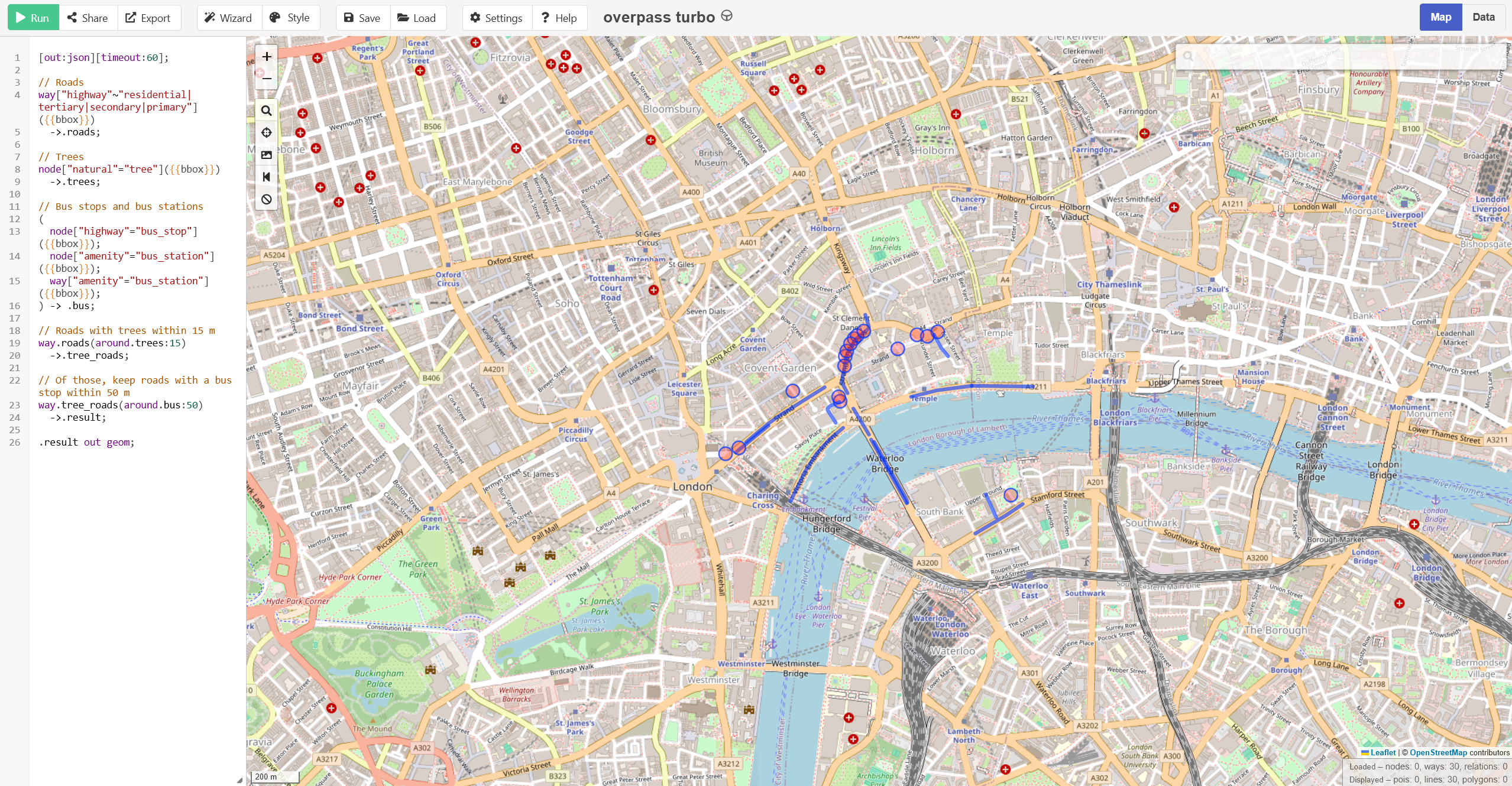
This narrows it down to 30 specific points in London. After scanning that clump of locations, I was able to identify the most likely spot.
Verification
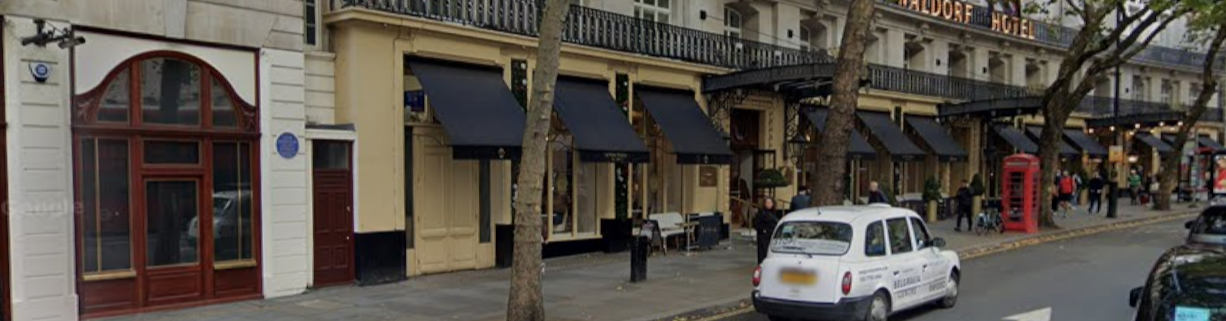
To verify the location, by lining up the building in the background with the black canopies.
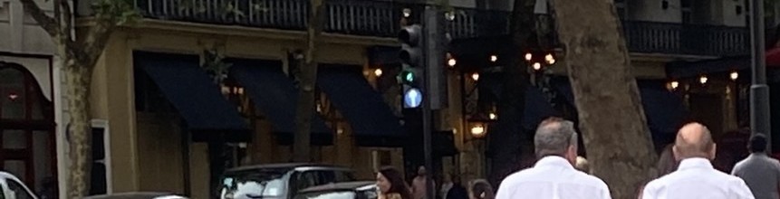
To find the exact GPS location, I had to take a few steps backwards to match the direction of the sidewalk tiles. Leading to this location
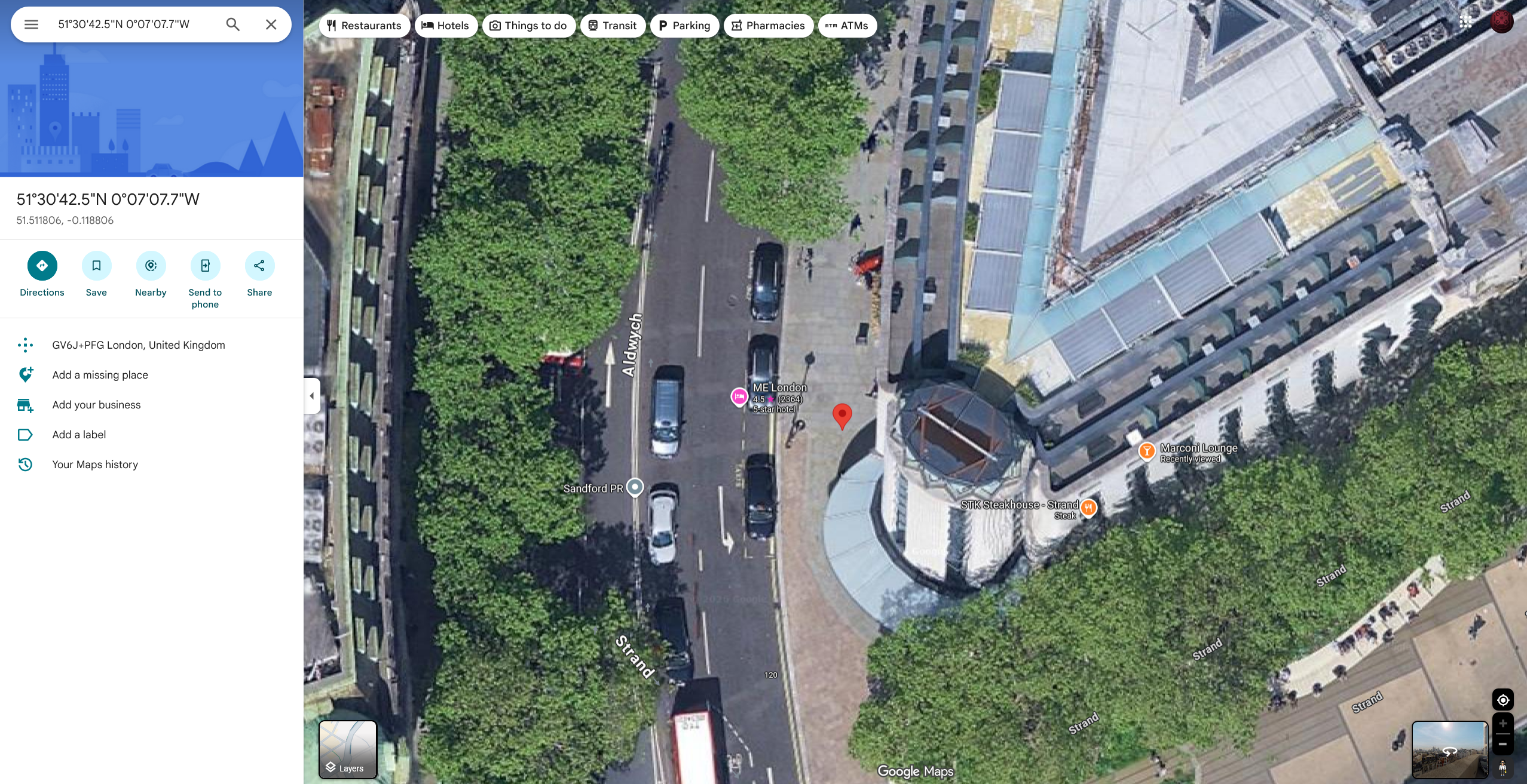
Unfortately, This flag required the exact GPS coordinates down to the millionths place, which could take hours of trial and error, but I was able to sucessfully verifiy the flag.
Flag
OSINT{51.511806°N_0.118806°W}Conclusion
This challenge was difficult and required more than such Google Maps to solve. Applications like Overpass Turbo were essential for analyzing the OpenStreetMap data and identifying the specific location. Unfortunately, I was unable to complete the flag on the website but I was able to determine the GPS coordinates of the photo down to a few feet.