Caught In The Act
CTF · ctf.osint.industries
Challenge Overview
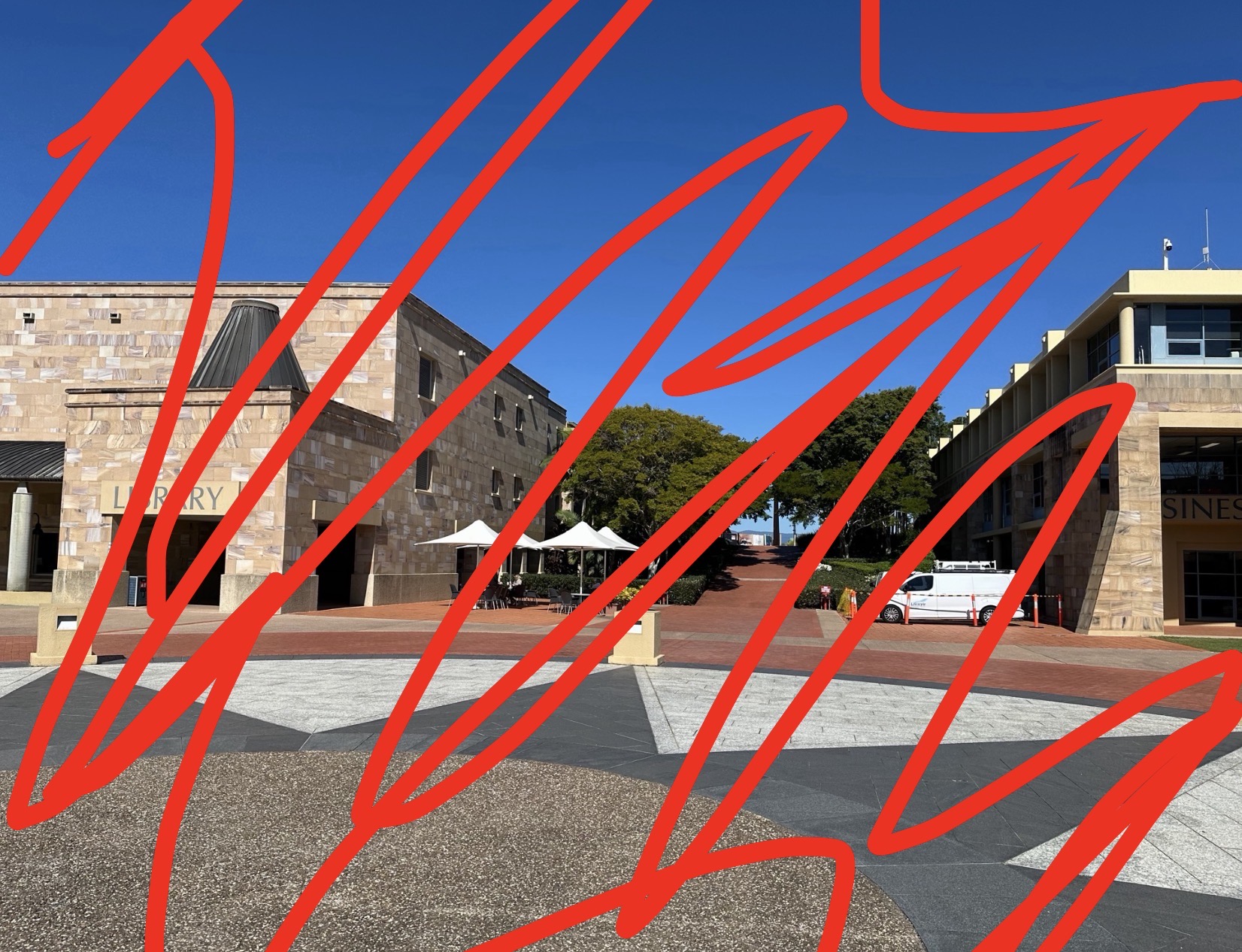
The goal of this challenge was to determine the location of a university based on a photograph and contextual clues. The flag format required the name of the univerisity and the city it was located in srrounded in quotation marks with underscores between words.
Initial Analysis
To start, I carefully scanned the photo for any visable words that to the university or its location. I noticed the words "Library" and what looked like the word "Business" on the buildings in the background. I also noticed it was very sunny and trees gave a tropical vibe, which suggested the university was likely located in a warmer climate.
The biggest clue that proved to be crucial was the pattern in the ground seeming to form a sun.
Finding the Location
Using Google image search, I was able to find the a photo online that seems to match the artiecture and has that unique symbol on the ground.
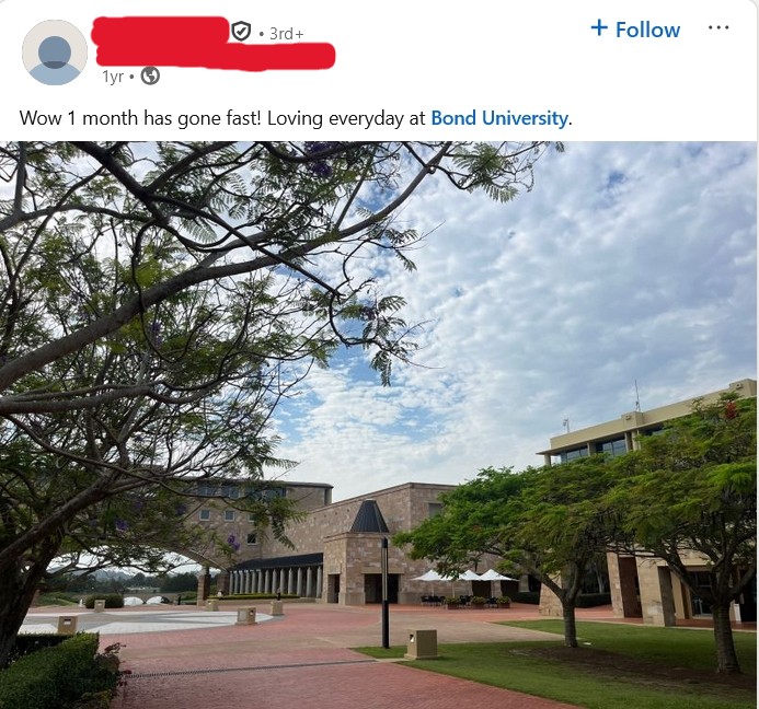
In the caption, I noticed the text "Bond University", which provided a strong indication of the location. Searching this name on Google Maps shows Bond University in Robina, Australia.
Verification
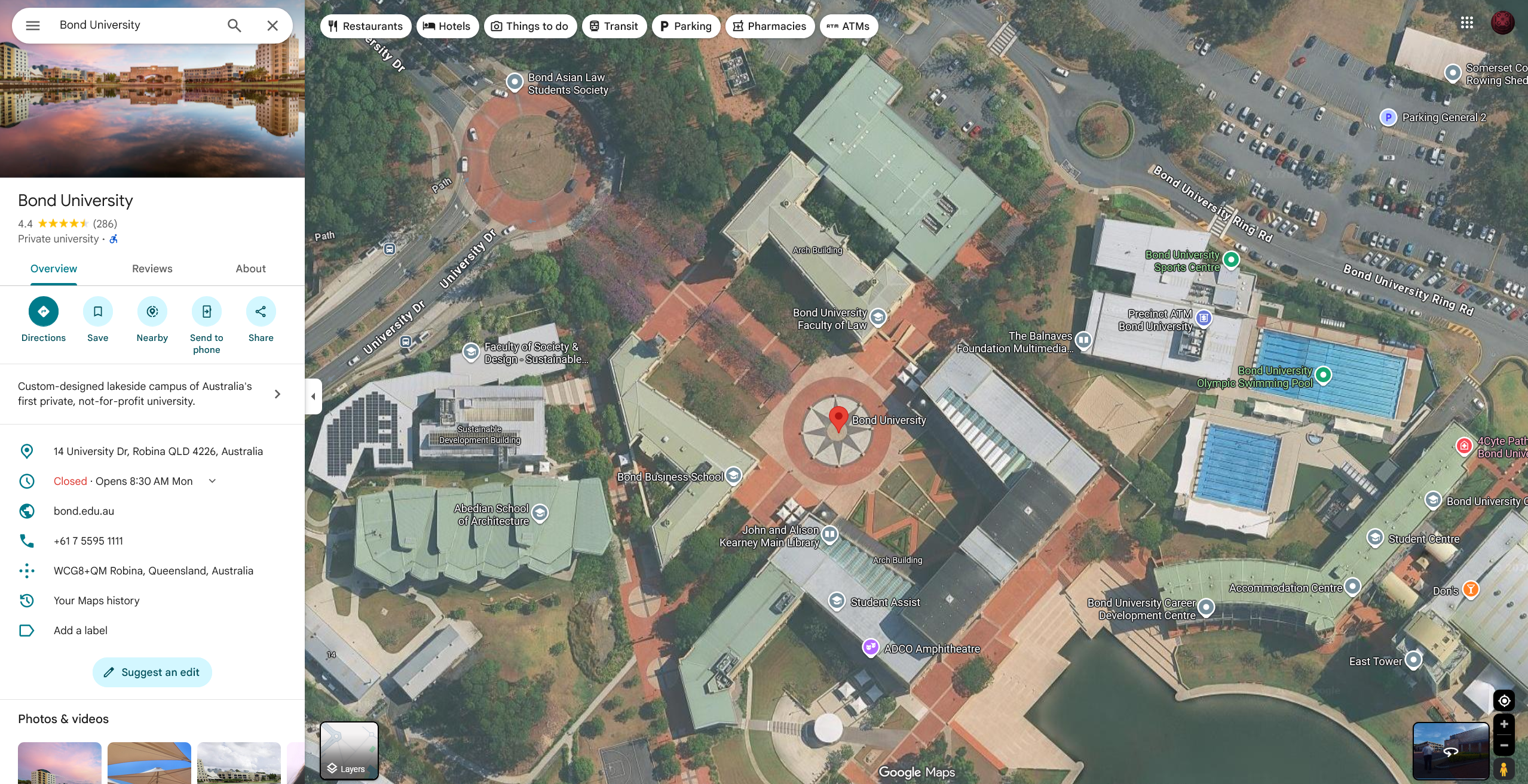
To verify the location, I compared satellite imagery and street views with the photograph. The buildings are made up of the same sandstone cladding, white tents, and 8 pointed star on the ground.
Flag
OSINT{"bond_university_robina"}Extra Step
To take this an extra step, I can find the direction they are facing in the photograph. I can do this by lining up the tents and the library, which results in the photograph being facing southwest.

Conclusion
This CTF challenge required a combination of visual analysis and online research to identify the location. By carefully examining the photograph and using tools like Google Maps and Street View, I was able to pinpoint the location as Bond University in Robina, Australia.